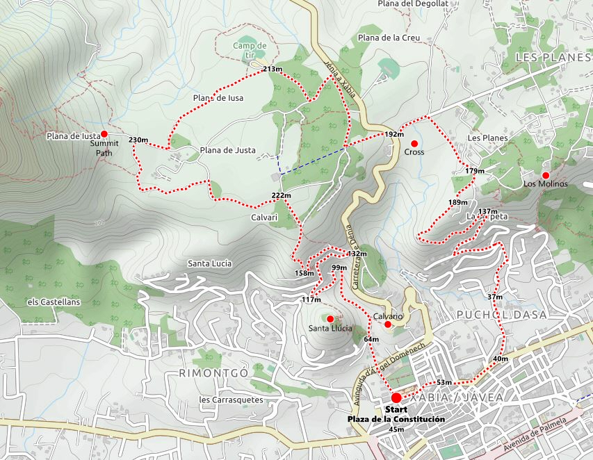
Route Description
This is a pleasant walk around the western part of the plateau of La Plana which nudges against the eastern flank of the mountain of Montgó, a circular route that is mainly of narrow path and rough track which accesses the high plain by way of a little used path behind the hill of Santa Llúcia. There are options to extend the journey by visiting the chapel of Santa Llúcia and the windmills of La Plana.
Route Details
- LENGTH: 11 kilometres
- TERRAIN: road and rough track
- EQUIPMENT: Sturdy Footwear, Camera, Water
- START: Plaza de la Constitución (N 38º 47′ 22″ – E 0º 09′ 37″)
There is plenty of parking underneath the Plaza de la Constitución with options for a pre-walk coffee in one of the nearby bars. With the apartment block and the police station behind us, the route heads to the left to pass up Calle Rafael Echagüe with the modern Conservatori Professional de Xàbia on our left.
Crossing the busy Avenida Ángel Domènech by way of the pedestrian crossing, the route continues straight on into Calle de Santa Llúcia, passing to the left of a tosca stone cross, and at the end of the road we find a lone olive tree.
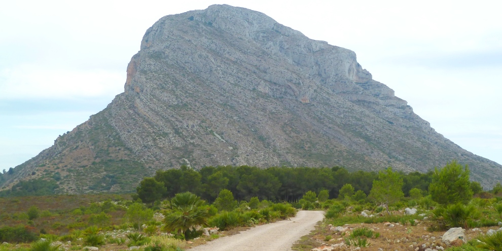
To the left, the SL-CV 99 Ermita Santa Llúcia path winds steeply up to the top of the 162m high Tossal de Santa Llúcia on top of which is the small white 15th/16th century chapel of the same name and there is the option to climb to the summit and rejoin this route on the other side. However, our route continues to the right of the tree to join the rough track of Camí de Santa Llúcia as it climbs steadily through the trees.
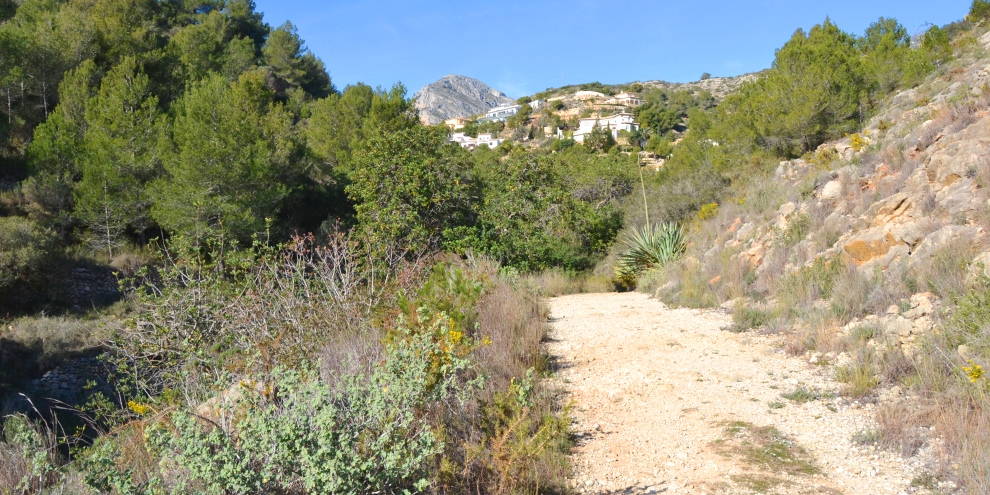
In a few moments, the summit of Montgó appears ahead of us; look behind and the blue-domed Ermita del Calvario dominates. After a few minutes, the path joins tarmac, the end of Calle Ponferrada (also known as Calle Badajoz on older maps) and the route follows the road as it climbs around the head of the gorge, affording some great views south of the two chapels. Close to the top of the road, a wide track enters from the left as this is another route to the top of the Santa Llúcia hill and where those who took the option to climb up to the chapel will rejoin this route.
At the crossroads, the view ahead is terrific with the inland mountains rising steeply above the valley. The route turns right into Calle Lastres and follows the road as it climbs up for a few hundreds metres to the junction with the busy Carretera de Denia. The views to the south are becoming better and better with the sea and the extended arm of Cap Prim marking the southern boundary of the bay of Jávea. At the end of the road, there are rubbish bins and the busy main road ahead of us but the route turns back on itself to climb the steep narrow road (also called Calle Lastres on some maps) which levels out and follows the contours around the head of the Santa Llúcia gorge.
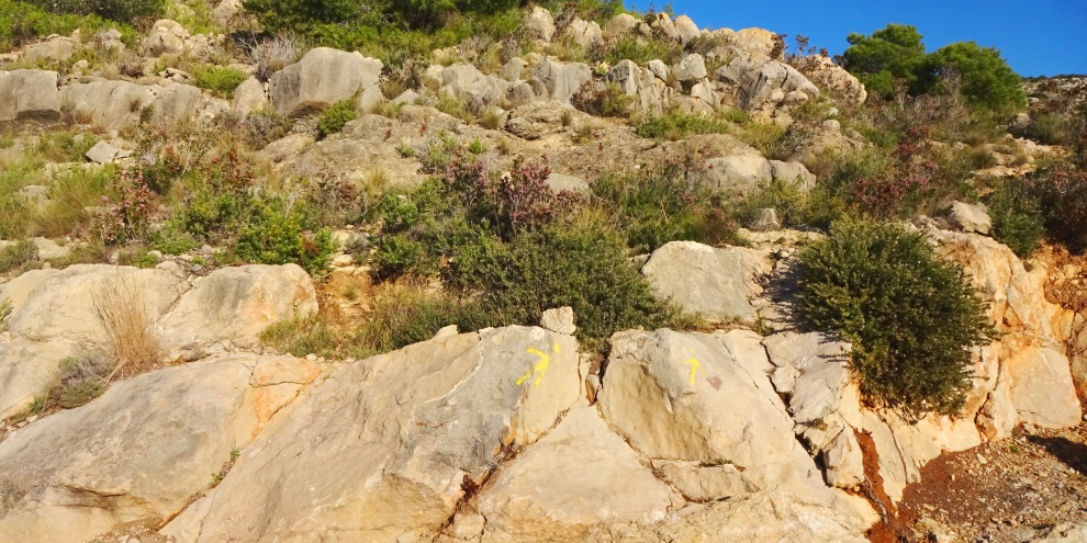
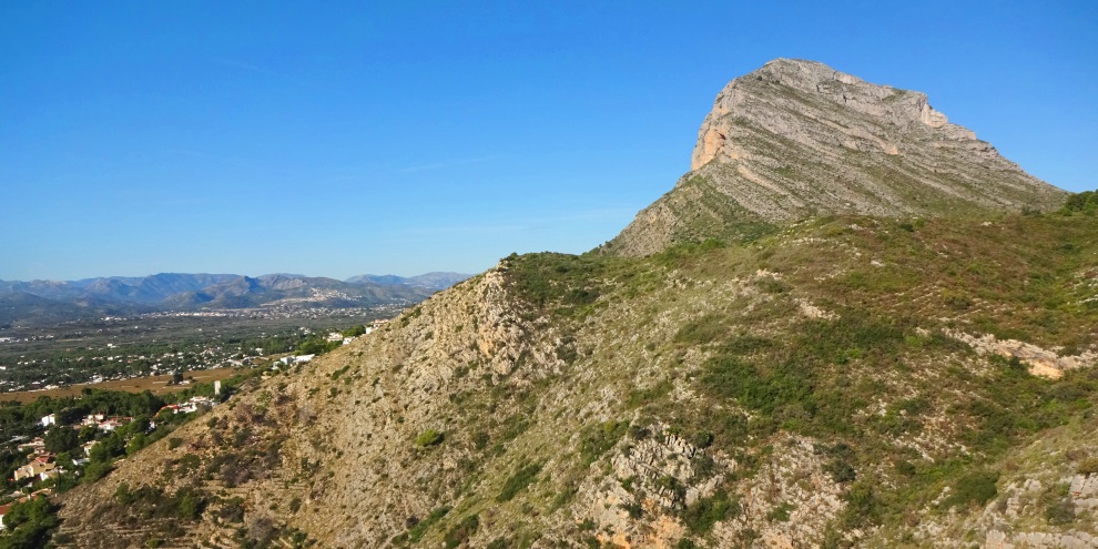
With a villa on the left, the road bends 90º to the right and here we are looking to leave the tarmac and climb up onto the plateau by way of a little used path. On the right, painted onto the rocks, there is a yellow arrow. Climb onto the rocks and a path should become obvious. Keep following the path – occasional yellow markers will guide you – as it winds up the slope. Quite soon, the massive bulk of Montgó will reveal itself in all its glory. As you climb, look carefully at some of the rocks over which you are passing; you may notice shells embedded into them, remnants of a very distant time when the ground beneath your feet was under water.
At the top of the path, there is a clearing. To the left, it continues for 100m or so before reducing to a track which disappears into the ravine below. To the right, a wide track leads off towards the main road; be aware that there are bee hives nearby. But our route continues straight on, climbing up a slope and then pushing along a narrow path alongside the trees.
After a few hundred metres, it joins a major crossroads of forest paths. We turn left and follow the path towards the awesome eastern face of Montgo. After 500m or so, we come across another junction and turn left to continue our march towards the mountain. As the path bends to the right, keep an eye for a painted arrow on the left side which marks the way to the eye of Montgó.
When the path ends in a T-junction. Turning left will take is to the start of the path to the summit of Montgó; perhaps that’s for another day. So we turn right and after about 200m or so, a path leads off into the trees to the left. This path takes us past the Dénia shooting range; there are great views to the left across Dénia and beyond whilst the shape of Montgó continues to change behind us. We emerge on to a wide track with the shooting range and its car-park to the left of us. Turning right, we follow the track down to the main track and then turn left to walk towards the main road.
Just 30m or so before the main road, look out for the yellow-and-white painted markers on the left which show the official path that passes through the trees. Keep following the obvious track and the markers painted on the trees until it emerges into a clearing and rejoins the forestry track that circles around the plateau. To the left is the main road whilst our route continues straight on for about 200m to a point just before a forked junction. On the left, a track leads into the undergrowth; there is a low wooden post with the yellow-and-white markings painted on it. Follow this track all the way to the main road and then, taking care when crossing, continue the follow the markings as the route follows Carretera del Cap de San Antoni for 200m to a junction. To the left, there is a rubbish and recycling point and a road which leads to the Torre del Gerro but our route turns right into Camí dels Molins; a wooden signpost indicates the way to [Molins | Port Xàbia].
Follow the road for about 400m to another fork junction with both options signed as no-through roads. The left option leads up to the Molins, the remains of the windmills which form one of the miradors – “viewpoints” – of Jávea whilst our route takes the right-hand fork into Camí Serpeta. After about 75m, turn left into a wide track and follow all the way to the houses where, partly hidden by the bushes on the right, a narrow path leads away with a stone wall to the left and a view across the narrow gorge to the right.
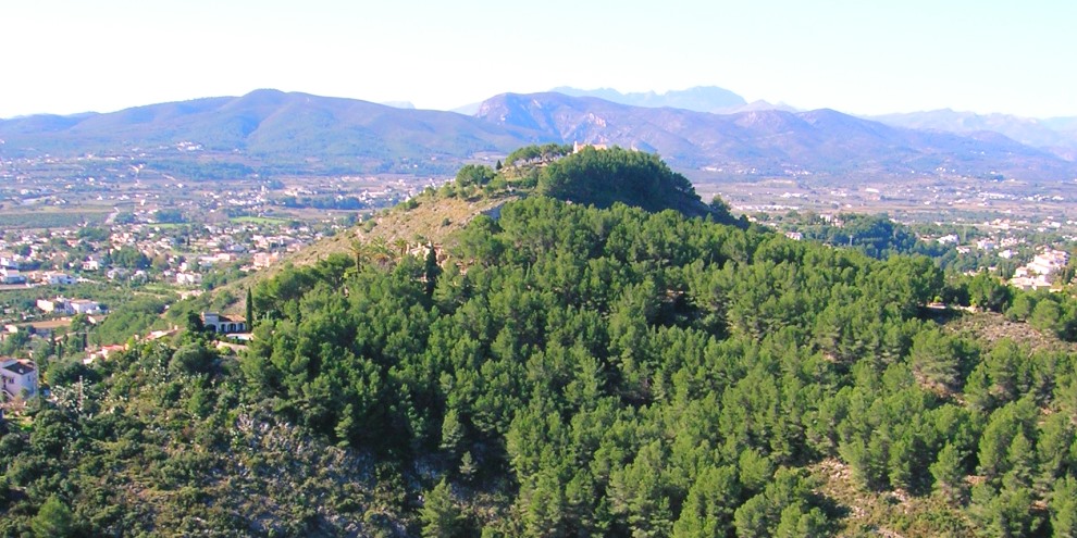
The route continues along the narrow path which opens up into a wider track. Directly ahead is the low hillock of Santa Llúcia with the white walls of the chapel just about visible through the trees. To the right, the mountain of Montgó is unmistakable whilst the busy main road between Jávea and Dénia winds its way up the hill. To the left there is a set of low stone walls next to a pair of rusty gate posts, the presence of both suggesting the location of enclosures or dwellings.
The track descends steeply and bends to the left to reveal a fantastic view of the town of Jávea with the distinctive hairpin bend of the Carretera de Dénia suggesting similarity to a famous grand prix track in France. As the track continues its descent, both the port and the Arenal areas come into view and there is a fantastic view right across the valley from the sea to the inland mountains. Up on the left, three towers appear, more remnants of the windmills that lined the ridge.
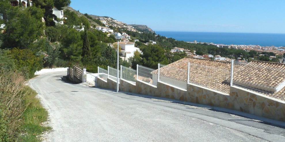
The track eventually drops into the Urbanisation El Pujol and into Calle Azuébar. We follow the road down to the junction and then turn left into Carrer del Putxol to continue the descent. At the bottom, we follow the road as it bends to the right into Calle Calderón and continue down across the junction and straight on until we pass into the built-up area in the town and arrive at Avenida de Alicante.
Turn right and walk along the elevated section and continue following the main road to the post office square. Between the post office and the restaurant, follow the road down to the Plaza de la Constitución and the circle is complete.
Time for a post-walk coffee. Or something a little more rewarding…
RELATED LINK: Visiting – The Parks
RELATED LINK: Walking – La Plana Close to Montgó
RELATED LINK: Walking – SL-CV 99 Ermita de Santa Llúcia
RELATED LINK: Walking – PR-CV 355 Port Xàbia to Montgó
RELATED LINK: Walking – Cova Ampla (The Eye of Montgó)
RELATED LINK: Walking – The Summit of Montgó
“Look deep into nature and you will understand everything better.”
ALBERT EINSTEIN (1879-1955)
Theoretical Physicist