AEMET issues risk alert for the potential for hail and strong winds over the weekend
The arrival of a mass of cold air across the Iberian Peninsula has the potential to bring heavy downpours and a noticeable drop in temperatures.

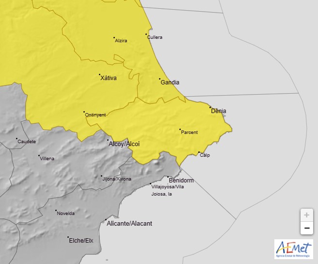
The state meteorological agency AEMET has issued a YELLOW risk alert for this weekend, warning of the potential for heavy rain and thunderstorms in the Marina Alta, the latter of which could be accompanied by hail and strong gusts of wind.
The first of two warnings advises that there is a 10%-40% probability of heavy rain throughout the region from 2.00pm tomorrow Saturday 26th August which could be accompanied by thunderstorms, valid until midnight.
The second warning advises that the probability of heavy rain increases to 40%-70% from midnight tomorrow night (Saturday) with the potential for an accumulation of 20mm/hour and these potential downpours could be accompanied by periods of hail and strong gusts of wind. The warning is valid until 8.00am Sunday morning.
As seen from the map below, the AEMET reporting area Litoral Norte de Alicante covers a wide area of very different physical features, from the flat plains on the coast to the high mountains and deep valleys of the inland. Consequently, it is possible that these conditions will affect some areas much more than others in this area. However, it is always best to be prepared for the worst.
The Climatology Department at the University of Alicante has explained that the Iberian Peninsula is about to experience a dramatic change over the weekend due to the arrival of a powerful mass of cold air associated with a trough. This has the potential to bring some showers to our region which could be locally very intense downpours, as well a a noticeable drop in maximum temperatures, particularly in the interior, to more pleasant levels.