Route Details
- Length: 2,2 kilometres
- Ascent: 82m
- Time: 1 hour
- Grade: Low
- Equipment: sturdy footwear, water, camera.
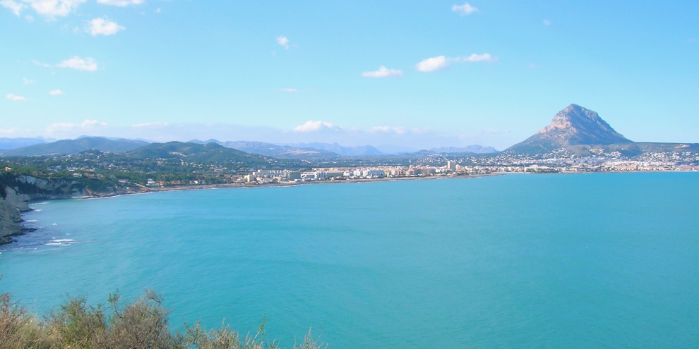
Cap Prim forms the southern barrier of the wide bay of Jávea and affords fantastic views to the north towards the mountain of Montgó and the Cabo de San Antonio. It hosts a unique micro-reserve of plants that makes it one of the most important ecological locations in the area with an abundance of Cheirolophus, Diplotaxis and Limonium; this also means that care should be taken to keep to the path and not cause irrepairable damage to the beautiful landscape. The colourful cliffs of Cap Prim, a mixture of grey and yellow marlstone, contrast superbly with the blue of the sea.
NOTE: There is limited parking on the main road and in Carrer L’Illa and it can be extremely busy during the popular summer months. Unfortunately there are no alternatives other than parking further down the hill in Cala Blanca and walking up to the viewpoint. Drivers should be aware of not blocking gates and driveway for they may return to find their vehicle removed on request of the property owner.
Route Description
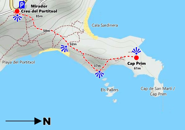
The start is at the Mirador Creu Portitxol, the picturesque viewpoint marked by a small tosca stone cross that overlooks the coast to the east with the island of Portitxol and the Cap Prim headland. The route descends along a well-eroded path past a wooden information board which outlines the natural history of the area as well as marking the two walking routes from this location.
After a few metres, the path divides with a wooden signpost indicating the two possible destinations: to the right is the short walk to Cala Barraca whilst our route descends left towards Cap Prim. The first few metres of the path are steep although there are a number of wooden steps and handrails to help if required, especially when wet.
There are a number of a small paths that lead off in all directions but you should remain on the main route which is marked by the green-and-white painted lines. A great deal of erosion over the past few years has resulted in a number of detours having to be forced around the fragile landscape; a few wooden barriers prevent one from getting too close to the weak edge but care should still be taken.
As we pass along the route towards the end of Cap Prim, there is a small isolated cove to the left known as Cala Sardinera. The cove is probably best known for the sardine industry – hence its name – when fine nets were drawn across the cove at sunrise and sunset to make the catch. These days the cove is a popular anchorage point for the many leisure craft that fill these waters during the summer months. There is a small path that descends to the cove to provide a variant to the established route.
After about 500m the path breaks from the trees and passes onto the level area on which there is a wooden signpost indicating the direction to Cap Prim (straight ahead). We continue onwards, checking our way on with the route markers as the view to the right opens up over the Cala Els Pallers towards the island of Portitxol. Look out for the natural seat formed by a low wooden branch that provides a perfect resting seat to admire this fantastic view.
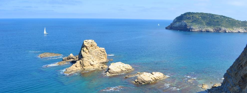
The path begins to climb towards the final ascent to Cap Prim. Stop and admire the row of rocks known as “Els Pallers” which protect the southern flank of a small cove which is enjoyed by hundreds of scuba divers each year. A wooden handrail prevents one from getting too close to the long drop to the rocks below!
The path winds its way along the edge of the cliff – keep your eye on the edge whilst admiring the views opening up to the north – until it covers the last few metres of well-eroded marlstone to the path end, marked by a wooden signpost. There is an obvious path that continues towards the end of the headland but progress is not encouraged to protect the fragility of the coastline as well as the life of the walker!
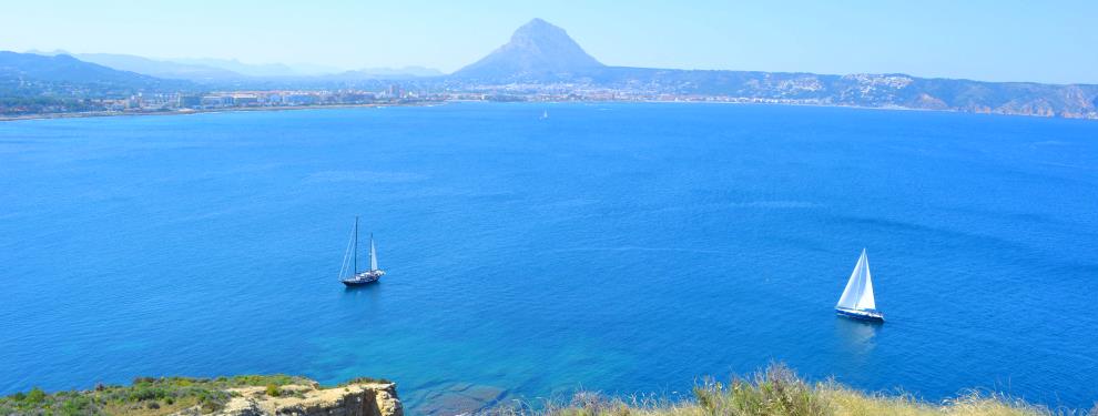
To the north there is stunning view of the coastline of the bay of Jávea, stretching from the cliffs of Cala Sardinera and Cala Blanca to our left, along the low ancient fossilised sand-dunes that makes up the rocky coastline and along to the very tip of Cabo de San Antonio to the right, with the mountain of El Montgó the dominant feature.
To the south, across Els Pallers rocks, the island of Portitxol sits apparently moored fast off the coast; it’s a private island now but remains of roman habitation have been found on its bulk, reflecting the fact that this part of the coastline has long been a natural harbour. Beyond the headland is Cap Negre, its snout dropping steeply into the sea.
Return via the same route.
RUBBISH: Sadly, the popularity of this route means that there is often a large amount of rubbish discarded by those selfish individuals who don’t appreciate the beauty of the nature around them. We don’t doubt that the local council tries its best to discourage this antisocial behaviour but its contractors can’t be everywhere, all the time. So we encourage those who can do so to take a rubbish bag and collect any rubbish that they come across during the short journey to and from the end of the headland. Your actions will be appreciated by the majority who enjoy this beautiful landscape.
RELATED LINK: SL-CV 97 Cala Barraca
RELATED LINK: Visiting Jávea – The Beaches
RELATED LINK: Visiting Jávea – The Viewpoints
“As we are standing on a dazzling cliff, overwhelmed by a blizzard of unanswered questions, the alarming immaterialities of our living may cry out to us and our consciousness may ask us to account for what we are doing or for what we have not done. This may be the instant we might engineer our future with destiny. “
ERIK PEVERNAGIE (1939-)