SEPTEMBER IN THE RAIN
A well-known saying perfectly sums up this time of year: “September either dries up the fountains or takes away the bridges”.
As we enter the late summer, knowing eyes will looking occasionally at the sky for this time of year has long been associated with the torrential rains that bring the season to a close; the phenomenon known as the gota fría but a term that has recently been usurped by the acronym DANA, an isolated depression at high altitudes.
There has been some talk that a gota fría is on the cards for early next week and meteorologists confirm that a huge anti-cyclonic bridge is likely to form between Newfoundland and eastern Europe over the weekend, although this is not unusual for this time of year. It is also true that forecast models such as ECMWF are suggesting that a trough of low pressure is going to break away over the Western Mediterranean which may form into a DANA which could result in very intense or torrential rain storms in some areas of the Mediterranean coast. But those meteorologists also admit that it is impossible at this moment to be absolutely sure that this is what will happen. And, indeed, whether it will rain at all.
The truth is that storms and heavy rain are common in Spain at this time of year for it is the transition between the heat of summer and the cool of the autumn, when there is a great potential for cold air at altitude to combine with the evaporation from the still warm Mediterranean waters.
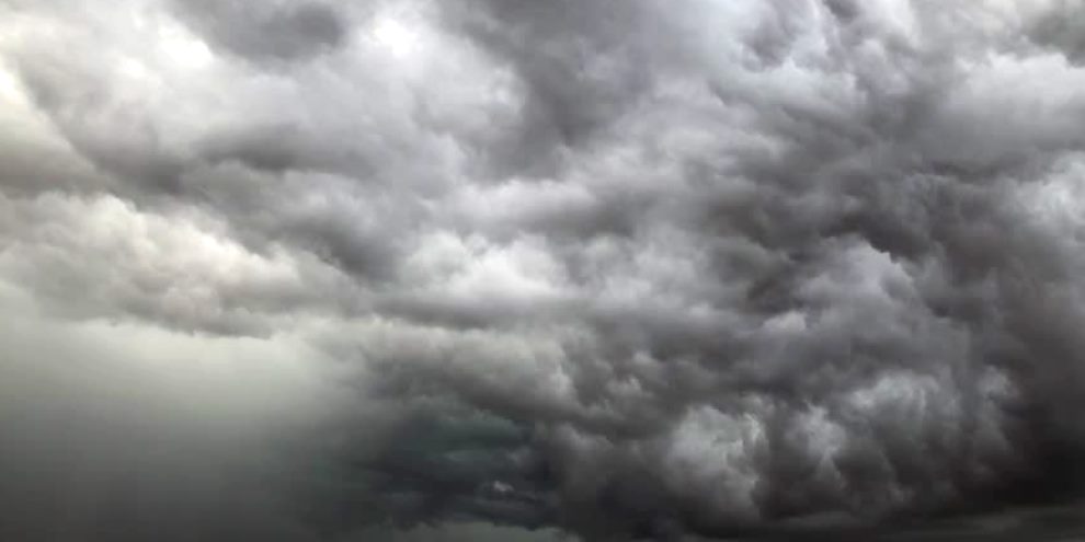
Some storms are often mistaken for the gota fría but the truth is that you will definitely know when it arrives, for it is that moment when cumulonimbus clouds, which have built huge stacks reaching high up into the atmosphere, climbing up and up until they can sustain themselves no longer, suddenly and violently release their water content in often devastating torrential rain storms. You will know.
Such a phenomena struck south-eastern Spain in September 2019, the worst storm for some 140 years that caused havoc across the Comunidad Valenciana, Murcía and eastern areas of Andalusia. More than 500 l/m2 fell on Orihuela in 48 hours – the annual average is around 250 l/m2 – and the town was cut off for three days due to the subsequent flooding. Rivers such as the Segura overflowed, flooding thousands of hectares of agricultural land, and Alicante airport suffered great damage from the flood water. By comparison, Xàbia escaped relatively unscathed. Back in 1957, it didn’t. But that’s another story for another time.
It should also be remembered that not all gota frías cause such torrential rain and potential devastation. Some can pass with little more than a parting shower. But the thing to remember is that they are part of our life here on the Mediterranean coast, a characteristic weather phenomenon that has been documented since Roman times, they are nothing new.
However 21st century Spain is a lot different than Roman Hispania. Water courses, lagoons and natural flood plains have been buried beneath the concrete of a developing civilization, places which suffer the most when these heavy rains fall on the land. So it is no surprise that when those rains do arrive, the flood water occupies those physical features which have been formed by nature to deal with it.
So, the best advice is to keep an eye on the weather forecasts and act on any warnings issued by AEMET, the state meterological agency, by preparing for the worst. Clean out drains and guttering. Sweep up and dispose of debris that might cause blockages. Bring in terrace furniture and tie down anything that might blow away. Perhaps most importantly, look to protect valuable documents and things of sentimental value. Don’t fear the gota fría but do regard it with the greatest of respect.
A well-known saying perfectly sums up this time of year: “September either dries up the fountains or takes away the bridges”. Having been living in Xàbia for more than 15 years, we can only agree.
SOURCES: El Tiempo / Laboratorio de Climatología – Universidad de Alicante