Oceanogràfic Foundation launches ‘Posidonia Project’ to map Posidonia in the Marina Alta
The project involves a cartographic study of the seabed of three coastal areas with a high representation of Posidonia meadows.
Wednesday 22nd April 2022 – Mike Smith
Source: original article – Carlos López (Xàbia AL DÍA)
The Oceanogràfic Foundation has presented ‘Project Posidònia‘ which aims to identify and enhance the meadows of Posidonia underwater seagrass and marine biodiversity in three areas located along the coast of the Marina Alta, funded by the ‘Mediterranean Fund’ of Banca March.
The project involves a cartographic study of the seabed of three coastal areas with a high representation of Posidonia meadows and which, in turn, are exposed to intense human activity.
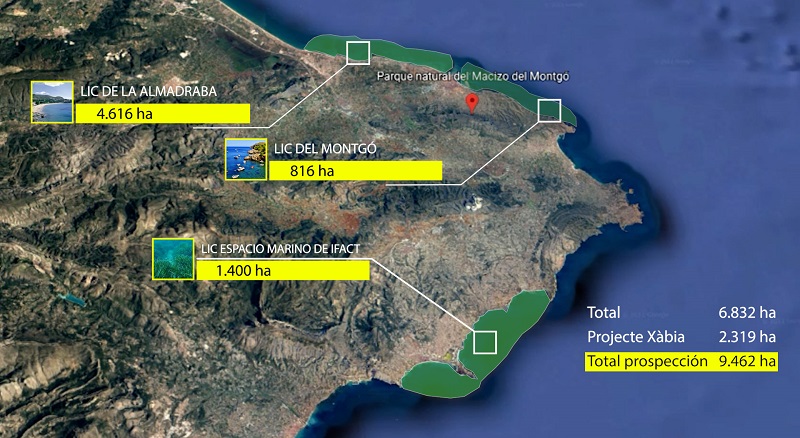
The ‘Posidònia Project’ will last two years and the study areas comprise a total survey of nearly 7,000 hectares, corresponding to ten football pitches, which include the Almadraba in Dénia area (4,616 ha), the marine area of the Parque Natural del Montgó (816 ha) and the Espacio Marino de Ifac around Calp (1,400 ha), all of them considered Sites of Community Interest (SCI) within the Natura 2000 Network.
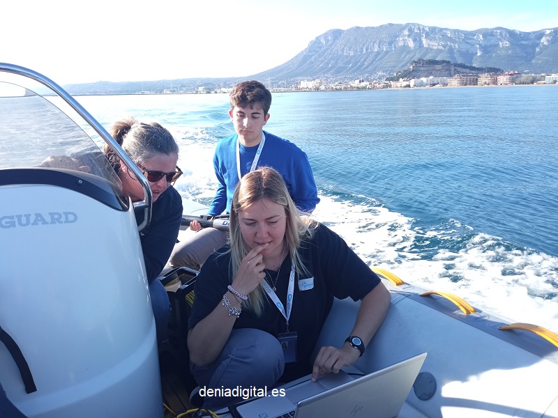
A side-scan sonar for mapping
To carry out this study, technicians from the Oceanogràfic Foundation are carrying out the mapping using side-scan sonar and videographic prospecting, a tool that provides high-precision digital images of the seabed to identify the exact location of the Posidonia seagrass meadows, distinguish between different types of seabed and thus be able to prepare the final mapping.
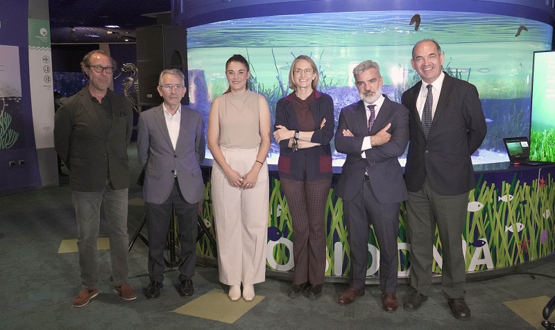
The presentation at the Oceanogràfic Foundation was attended by Celia Calabuig, president of the foundation, Francisco Torner, project manager of the ‘Posidònia Project’, Íñigo Colomo, responsible for the management of the Mediterranean Fund, and Mireia Mollà, Minister of Agriculture, Rural Development, Climate Emergency and Ecological Transition at the Generalitat Valenciana.
Celia Calabuig explained that “the ‘Posidonia Project’ is an opportunity to continue contributing to the protection of one of the most important and at the same time most vulnerable ecosystems on our planet, the Posidonia meadows, which are of great value for the biodiversity of our Mediterranean sea”.
She added that “the collaboration with other entities is always positive, but in this case we are very proud to be able to carry out this project with the collaboration of ‘Mediterranean Fund’ of Banca March, whose values are fully aligned with those we pursue from the Oceanogràfic Foundation“.
Project manager, Francisco Torner, explained that “thanks to the experience and knowledge acquired between 2017 and 2021 with the ‘Project Xàbia’ conducted by the Oceanogràfic Foundation-City of Arts and Sciences, we can extrapolate this rigorous method to other areas of the Marina Alta that also have an extraordinary marine biodiversity, with the aim of conserving a fundamental component of the natural heritage of the coast of the Comunidad Valenciana and considered one of the most influential ecosystems in the well-being of society”.
The Comunidad Valencia has the second largest expanse of Posidonia seagrass meadows in the Spanish Mediterranean, just behind the Balearic Islands, of which 75% can be found in the waters of the province of Alicante.
In this way, this action will provide a very important reference to monitor the evolution of these grasslands, recognized as a priority habitat by the EU, serving in turn as a tool for management and planning of spaces and as a vehicle to promote sustainable practices.
The ‘Project Posidònia’, which is funded by Banca March’s environmental solidarity thematic fund ‘Mediterranean Fund’, has already begun its first technical-scientific phase with the cartographic study of the spaces mentioned and will allow to update the knowledge and data of the surface on which the Posidonia meadows are distributed.
The mapping provided by this project, together with the one carried out within the framework of the ‘Projecte Xàbia’ in 2019 between Cabo de San Antonio and Cap d’Or, can be consulted in a free access mobile application, with the aim of facilitate the sustainable development of activities in these areas and avoid uncontrolled anchoring or any other type of interaction that could negatively affect the Posidonia oceanica meadows.
With all this, the mobile application will contain the mapping of more than 50 km of coastline and 9,500 hectares that correspond, in turn, to one of the areas with the greatest nautical and recreational activity in the Comunidad Valenciana.