The Despoblado Morisco de L’Atzuvieta – the abandoned Moorish village of L’Atzuvieta – is a sad reminder of the repercussions of the so-called reconquest of Spain by the Christian troops of Jaime I in the first half of the 13th century, a collection of ruins of a village that once house more than a dozen hard-working families.
It’s a sobering wander through the ruins of what was once a huge complex of houses, farmsteads and barns. A visit could also be combined with a visit to the Cova del Rull which is about 20 minutes drive away. Due to its deteriorated state, it’s not suitable for prams, pushchairs or wheelchairs and it’s worth considering wearing sturdy footwear to explore the ruins.
First … A Bit of History
The moriscos were former Muslims who was forced to convert to Christianity in the early 16th century if they wanted to remain in the country. At the time, the Kingdom of Valencia had the largest Muslim population in Spain after Granada and its lords tolerated the practice of Islam (for the Muslims were of huge economic value to their lands) until the Revolt of the Brotherhoods in the 1520s which bore an anti-Islam sentiment and forced Muslims to become Christians in territories controlled by the rebels. The rebellion was supressed by the Crown with the help of the Muslims but, despite the assistance, the king Carlos V instigated an investigation on the validity of the forced conversions and ultimately placed the issue under the authority of the Inquisition, demanding the forced conversion of the remaining Muslim population. Despite the royal decree, some Valencian lords permitted their ‘moriscos’ to openly practice Islam and Arabic continued to be spoken despite attempts to stamp it out.
The Muslim inhabitants of the areas of Vall de Gallinera, Vall d’Alcalà and Vall de Laguar had tamed the harsh dry innermost lands of the region of Valencia by creating irrigation systems that allowed them carve out an agricultural commercial sector which could provide tribute for the lords who largely left them alone, for they were cheap labour on which the economy of the kingdom of Valencia relied upon.
However, a growing belief that these morisco families were assisting the Barbary pirates who plagued the Valencian coast prompted Felipe III to sign a decree of expulsion in 1609, forcing the Moriscos to leave their houses and the land of their ancestors “under the pain of death and confiscation, without trial or sentence… to take with them no money, bullion, jewels or bills of exchange… just what they could carry.” Loaded onto boats in ports such as Dénia, they were transported to an uncertain future in Africa.
A third of the population of the Kingdom of Valencia was expelled, with the Marina Alta region particularly affected. Almost overnight, the economy of the Kingdom of Valencian collapsed as there was no-one left to harvest the crops. Those brought in from other areas of the country, such as Mallorca, couldn’t reach the levels of production of the moriscos and many of the old villages remained abandoned. And it is suggested that the Valencian region has never truly recovered as an economic or political powerhouse in the kingdom of Spain.
Ironically, many moriscos joined the Barbary pirates after their expulsion, attacking Spanish shipping and the Spanish coast.
Getting There
The abandoned village is about an hour’s drive from Xàbia. The easiest route is via Pego and the Vall d’Ebo. On leaving Xàbia, head for the N-332 and drive north towards Valencia. Pass by the shopping centre and Ondara to continue to the junction with the CV-700 [EL VERGER | PEGO]. take the CV-700 towards Pego and, as you enter the town, take the CV-715 [VALL DE LAGUAR] and follow it through the town to emerge the other side, driving towards ORBA.
After about 750m, turn right onto the CV-712 [VALL DE EBO]. The road winds up the hillside – there are a few hairpin turns to anticipate – and a stunning view over the Pego wetlands towards the sea opens up. Near the top – Port de Vall d’Ebo 540m – there is a small area on the right-hand side to pull up, get out and take some photos of the view.
As the road descends down into the Vall d’Ebo, there is a small parking area on the left-hand side after about 700m and this is the Mirador Barranc de l’Infern (510m), a stunning view over the deep canyon that is an extremely popular hiking destination.
Continue down into the valley and pass by the village of La Vall d’Ebo and, after another sharp hairpin, pass by La Cova del Rull. Continue for about eight kilometres – look out for the “hole in the mountain” of La Foradada to the right – and just before the village of ALCALÀ DE LA JOVADA, turn right onto a concrete road which drops down steeply; there is no sign except for a small white walking route indicator. If you reach the village, you’ve gone too far and need to head back the way you came for about 300m.
About 300m down the narrow road, there is a small parking spot at one of the entrances to the ruins, space for about three cars, but if you continue for about another 65m, there is much more space to park. The ruins are on the right.
Opening Hours
The Despoblat Morisc de l’Atzuvieta is open to the public 365 days a year.
Admission Price (2023)
The Despoblat Morisc de l’Atzuvieta is free access 365 days a year.
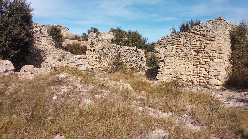
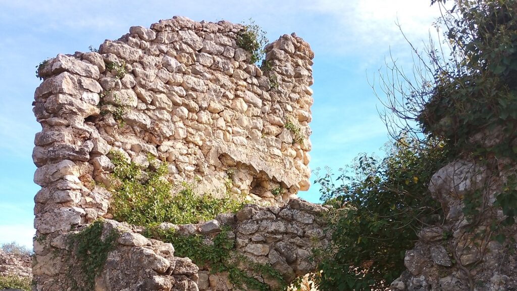
The Despoblat Morisc de l’Atzuvieta
There is an information panel at one of the entrances to the ruins but it seems to have been damaged by a recent fire so it is hoped that it will be replaced soon. The essence of the information is that the ruins are the remains of houses dating from Mudejar and Moorish periods which give us a good idea of the lives of the last moriscos who lived in them before being forcibly removed.
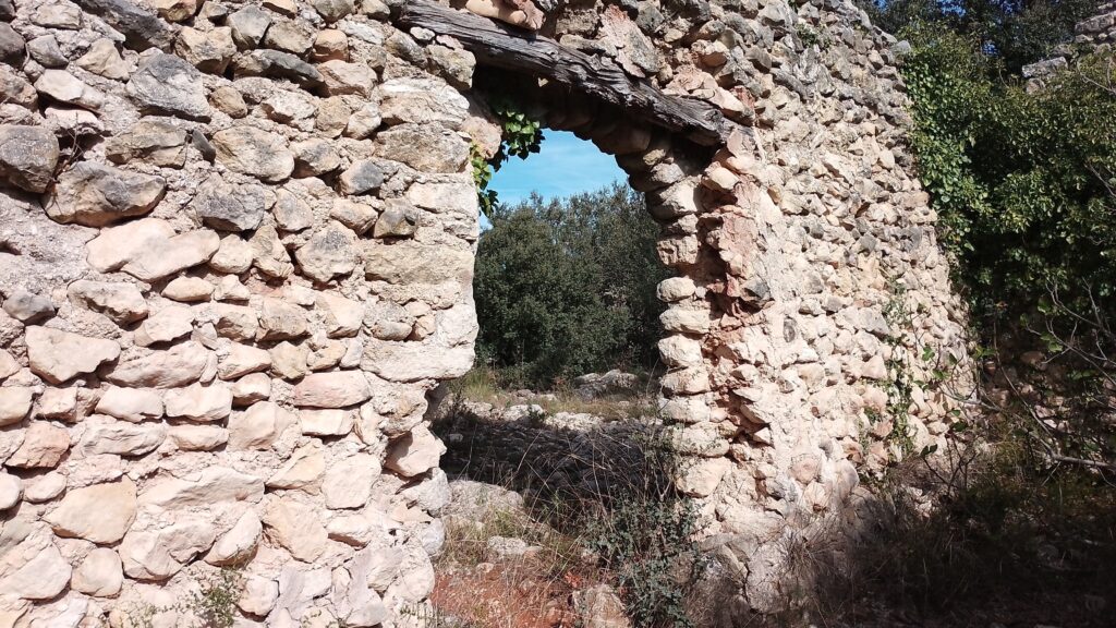
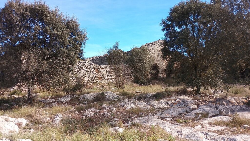
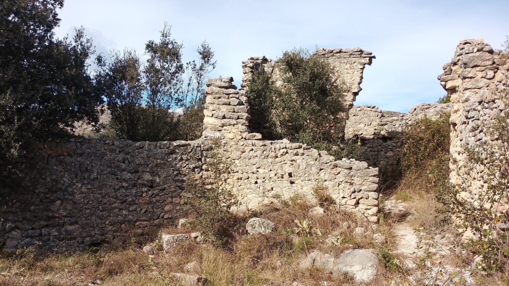
The houses have remained empty ever since, the walls gradually crumbling or modified by local shepherds in order to build a rough enclosure for their animals, and they stand as a monument to the tragic depopulation of these lands four centuries ago. The site is open so you are free to wander through the large complex; there are no more information panels or described routes, you should take your own time to imagine what life must have been like and marvel at the stone archways which are still standing as you scramble through holes in the adjacent walls.
The first documented reference to the abandoned village dates back to 1356, almost a century before the reconquent of Jaime I. It is estimated that just before the forced expulsion in 1609, there were 17 families living in the village. Some of the empty houses were occupied by Christian settlers but soon they too abandoned them.
The village sits on a rocky surface surrounded by crop fields above the river Girona which runs to the south. Since they sit on rock, they have no foundations and were built to a simple quadrangular floor plan with a patio and sometimes a room serving a separate sleeping quarters, a workshop, a warehouse or a kitchen.
Archaeological investigations in 2006 revealed that plaster was used to decorate the inside of the walls whilst the remains of an olive press carved out of the same rock on which the village sits were uncovered. In addition, the remains of a mill with an irrigation ditch that supplied water from a higher point along the river was also discovered.
Across the main road from the abandoned village is the Nevero de Baix, a small round structure that was built in the 18th century to store snow which was then compressed to form ice to supply local markets and ports such as Dénia.
From here, there is also a walking route to the Penya Foradá, the spectacular stone arch located at 737m above sea level which is regarded as one of the natural wonders of the province of Alicante and provides a stunning view over La Vall de Gallinera. This natural window also aligns with the setting sun twice a year – on March 9th and October 4th – with the beam of sunlight apparently illuminating the ruins of the Franciscan Convent of Gallinera.
Related Links
La Cantimplora Verde · Despoblado morisco de L’Atzuvieta en Alcalá de la Jovada, Alicante
VALENCIA BONITA · Una Ruta por la Penya Foradà