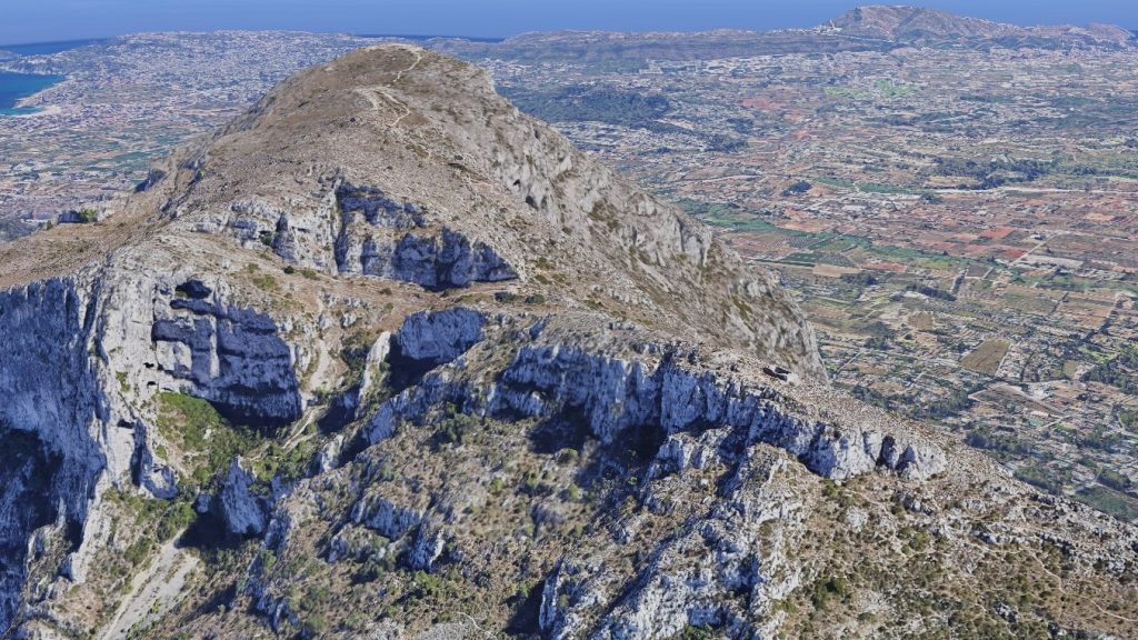
Close to the summit of Montgó, where the Mediterranean stretches to the horizon and fierce winds whip across jagged cliffs, stand the ruins of a lone cabin, a monument to courage, curiosity, and one of the boldest scientific missions of the Enlightenment. Over two centuries ago, two French scientists, Jean-Baptiste Biot and François Arago, faced this unforgiving landscape, determined to measure the world itself.
Biot, a prodigy of physics and mathematics, had an unquenchable thirst for understanding the cosmos. His calm, analytical mind was paired with a daring streak that made him fearless in the field. Arago, his companion and equal in intellect, was a restless polymath: physicist, astronomer, and politician, driven by insatiable curiosity and a taste for adventure. Together, they were an unstoppable force, a blend of brains, determination, and raw courage.
Their mission was part of a grand project launched by revolutionary France: to create a universal system of measurement. The metre, they knew, had to be defined with extreme precision; one ten-millionth of a quadrant of the Earth. Achieving this meant climbing mountains, mapping triangulations across hundreds of kilometres, and confronting nature in its most uncompromising forms.
In 1806, the two men set out for Montgó. Their original plan had been to measure the mainland mountains visible from Ibiza, assuming Cullera was the highest. But standing on the island’s cliffs, they realized it was Montgó that pierced the skyline, a sentinel of stone challenging them to scale its summit.
The ascent tested every ounce of their resolve. Winds tore at their clothes; the rocky terrain threatened to send them tumbling; the cold gnawed at their hands and faces. Yet Biot and Arago pressed on, step by gruelling step, finally finding a narrow plateau 42 meters below the peak, still within Xàbia’s borders, where they would build the cabin.
Once the cabin stood, their nights were consumed by a ritual of light and precision. Mirrors and beacons sent flashes across the darkness, visible as far as Sa Talaia in Ibiza and the Desert de les Palmes in Castelló. Every spark of reflected light allowed them to record measurements, triangulate positions, and inch closer to the universal metre. The mountain became a laboratory, the wind their constant companion, and the cold their ever-present adversary.
The cabin itself, built from the dry-stone technique of the Marina Alta, was a fortress against storms. Its walls, a metre thick, outlasted the original wooden shelter, which had been destroyed by the mountain’s fury. Today, fragments of these walls endure, tangible evidence of human ingenuity, perseverance, and the audacity of two men who measured the world under the harshest conditions.
Today, the ruins are located at approximately 38°48’23.6″N 0°07’28.3″E, a precise point that allows modern adventurers to follow in their footsteps. Energetic visitors today can follow their path: ascending the mountain from Xàbia via the port or the shorter trail from Campo de Tiro, or taking routes from Creueta de Dénia or Jesús Pobre. Standing amid the ruins, it is easy to imagine Biot and Arago debating calculations, scanning the horizon, and marking the points that would change science forever.
Ca Biot is not just ruins. It is a symbol of human daring, a testament to curiosity and endurance, and a monument to a time when two men dared to challenge nature and measure the world from a windswept mountaintop.